Muhlenberg County Kentucky
Cemetery Records
Turner Cemetery
| Surname | Name | Birth | Death | Other Info | Image |
|---|---|---|---|---|---|
| Turner | Rev. Samuel | 19 Nov 1802 | 19 Nov 1880 |
Hammers' transcription includes the following: Large sandstone beside the [Samuel Turner] grave above but is down [also] many sandstone markers.
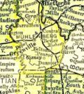
Location: Located about 300 feet in woods where Kentucky Route 973 intersects Myers Chapel Road.
Approximate coordinates based on Hammers' map and coordinates: 37.091271, -87.018371.
Source: Muhlenberg County Kentucky Cemeteries by Marian G. Hammers, Vol. 2 (1977), p. 93.
Updated November 7, 2018