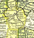
Muhlenberg County Kentucky
Cemetery Records
Walker Cemetery
| Surname | Name | Birth | Death | Other Information | Images |
|---|---|---|---|---|---|
| Holland | Janie | 24 Dec 1883 | 24 Oct 1885 | Shared stone with Merida Holland Inscription: Son & dau. Of S.H. & S.L. Holland | |
| Holland | Matilda | 12 Dec 1880 | 18 May 1881 | Inscription: Dau. of S.H. & S.L. Holland | |
| Holland | Merida | 12 Dec 1881 | 24 Dec 1885 | Shared stone with Janie Holland Inscription: Son & dau. of S.H. & S.L. Holland | |
| Walker | M.C. | 24 Nov 1832 | 30 July 1922 | Inscription: Wife of M.K. Walker | |
| Walker | M.K. | 4 Mar 1827 | 25 Jan 1892 |
Directions: From Greenville, drive about 10 miles south on KY-171. About 1½ miles past the KY-831 intersection, turn onto PR-1203. This is a unpaved road on the right hand side of the road by a barn. While the cemetery appears clearly at the coordinates listed below, it is unclear how exactly to get there. I'm assuming PR-1203 is the correct way there.
Coordinates: 37.059119, -87.238284
Citation: Hammers, Marian G. “Walker Cemetery.” Muhlenberg County Kentucky Cemeteries. Vol. 4. Madisonville, KY: Marian G. Hammers, 1980. Page 68.
Updated October 11, 2017